Saturday morning we packed up our (soaking wet) tent and headed north and east.
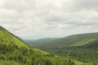
Along the way we drove through several different habitats, thanks to the protection of the mountains from the ocean winds. One little ecosystem was this sugar maple forest made up of 200 year old trees.
It was donated by a man of Scottish heritage, whose one stipulation was that a replica of a shieling, or a Scottish sheep crofter's hut.
The valleys between mountain ridges were never ending.
On the eastern side of the island we visited the charming harbor town of White Point. Obviously a fishing village, the water and mountain views were just unbelievable.
We were amazed at how isolated these little towns were. This one was located many miles away from anything - store, church, medical center.
At the point was a white cross marking an old grave...
Neil's Harbor lighthouse...
It cracked me up that this quaint little working lighthouse doubled as an ice cream parlor!
We had lunch at the chowder house, located pretty much in the middle of nowhere, we were rather skeptical as we followed old signs to the restaurant, which was a shack-like building on a bluff overlooking the ocean. We were rewarded with great seafood!
An important note - that horse trailer looking thing is an example of a Canadian garbage can. They are crazy about separating their garbage in the Frozen North! Even McDonald's.....they needed to post directions so the clueless folk like us could figure out how to toss our trash.
Views from the yard around the restaurant...
Long ago these rocks had cracked, allowing lava to fill the gaps and leaving pink criss-crossing throughout!
Our first challenge on this side of Cape Breton was the hike to the top of Franey Mountain. Trail guides promised a steep climb up the mountain, possible moose, bear, or coyote sightings, with panoramic views of the coastline and valleys at the top.
The part about the steep climb was right! We were so winded clambering over rocks and washed out areas that we didn't even get the camera out until we got to this staircase on the "easy" part.
View from the top of staircase....
We thought we were close to the top.
We were wrong.
Love Canadian warning signs!
The view from the top of the mountain. Maybe if all the scrubby trees were cut down we could have seen more?
The spit of land in the center of the photo is the Middle Head Trail, which was our next hike. Cape Smokey is to the right.
Views from the Middle Head Trail...
Interesting fact about the Middle Head Trail:
Whenever we're on a road trip we record all the license plates we come across. We saw our first Kentucky plate in the parking lot of the Keltic Lodge which is located just before the trail. They were driving a Camry, too. Of course. =)
Ingonish Harbor sun set and moon rise.
The view from the harbor was incredible. The Middle Head Trail and Cape Smokey to our right, Ingonish Island to the front....
The moon rose right behind the island (of course) so we missed seeing it pop out of the ocean. It made for very pretty pictures anyway!
It's a good thing this picture is not scratch and sniff. We dubbed this picturesque area "The Beach of Death". It STANK and crab and fish parts littered the sand. Looks pretty at night, though!


No comments:
Post a Comment