After 5 days of camping in 3 different campgrounds in 2 provinces, we were more than ready to pack up and were looking forward to a few nights in a real bed with a private bathroom. Oh, the luxuries!
Our way down the eastern coast of Cape Breton Island was marked with many bilingual Gaelic signs. We also passed the Gaelic College, causing me to briefly think I had had a stroke and could no longer read.

The distance between Ingonish on Cape Breton and Quebec City was about 13 hours, so we planned to spend the night in New Brunswick's capital city of Fredericton. The trip there was rainy. Pretty much the whole 7 hour drive. And the night we spent there. It was a beautiful old Victorian house located along the St. John River, but you'll have to take my word for it since it poured so much there was no way I was going to subject my camera to a drenching. After indulging in the many course breakfast and chatting it up with a very nice couple from Saskatchewan, we got back into our car for the 6 hour drive to our next destination.
Crossing the border into Quebec was scary. The road signs were in French, with no helpful English translations. Fortunately, we only had to follow the St. Lawrence River to get the city. The drive was beautiful, and if you ever have the opportunity to travel it by cruise ship, I'd say go for it! We arrived in the city in late afternoon, found our bed and breakfast with little difficulty, and then made our plans for the evening.
Our host, Danielle, was very nice and tried very hard to make her English understandable. She gave us a map, explained the city and suggested some good restaurants. Our B&B was below the Plains of Abraham, and we had a 300 step staircase to climb to get to the city. There's nothing like a 300 step staircase to remind you how unfit you really are. Especially being passes by people jogging up and down for exercise. I think one guy lapped us at least 3 times.
But the torturous "Staircase of Death" was worth it. Much of the Plains was blocked off with stage and lighting equipment in preparation for Celine Dion's visit.
FYI: The people of Quebec City really like Celine.
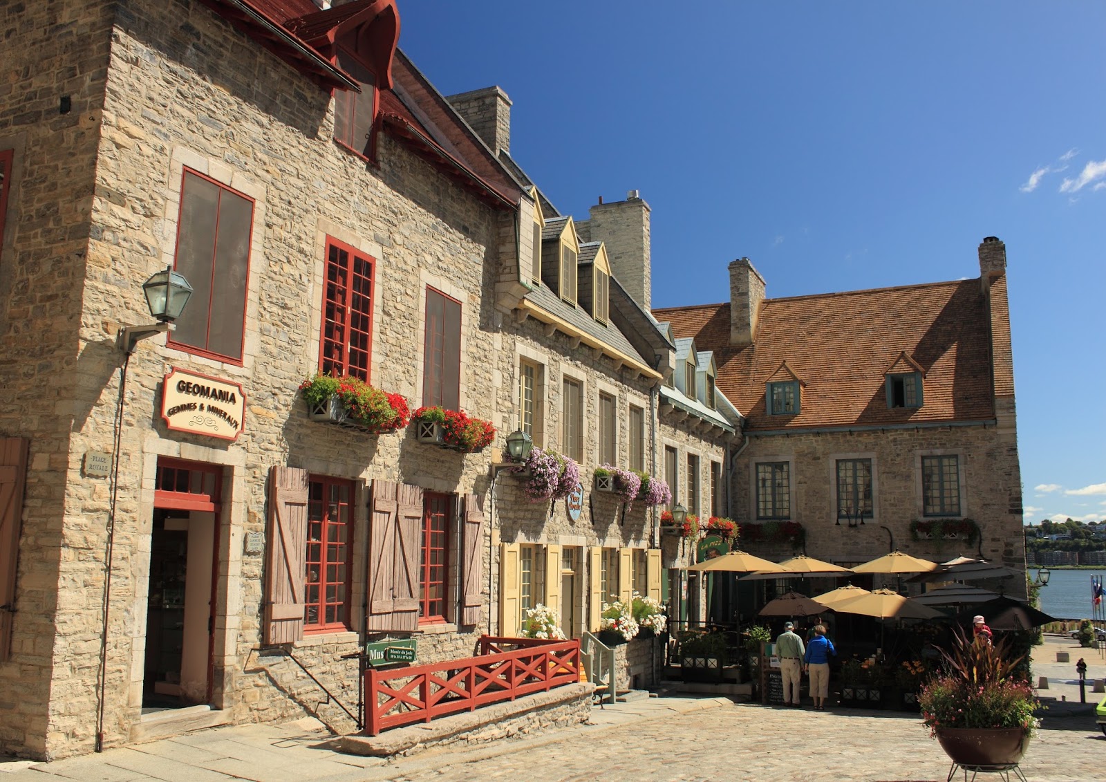
We strolled the city, admiring the views, and made our way to a little crepe restaurant. To our surprise, right outside the restaurant was a bike race. We were able to sit at an open window, eating our crepes, sipping hot chocolate, while people watching. It was a great evening!
The next day we had no real plan in mind, just to enjoy the city and pick up a few souvenirs for the girls. The flower baskets hanging....everywhere!...were beautiful! It definitely felt like we were in Europe.


Chateau Frontenac in the distance...


Chateau Frontenac is a hotel that rises high above the city. We were rebels, ignoring the signs that non-guests stay in the lobby we rode the elevator to the top floor and then took the staircase down, admiring the view along the way.


Quebec City is the only walled city in North America. The wall extends around the older, upper part of town.

We didn't get to see the changing of the guards at the Citadel, but we did visit and tour the museum.


Parliament Building
This building had more creepy bronze statues than any other building I've even seen. The front and sides were polluted with them!


Gardens located beside the Plains of Abraham


The Funicular takes people between the upper and lower parts of the city.


Every night Quebec City gives a free performance of Cirque du Soliel. It was a mad rush to get in and we were one of the last few people to get in before the gates were closed. We had to stand, but we had a pretty good view. The show was really good.....but it was also really French. We were left guessing as to what the plot actually was......history of Canada? No....it was something about a box...


In any case, the music was good, the acrobats were amazing, and the price couldn't be beat! Afterwards the people funneled to the pier where another free show was held. This one was in English....and we still didn't get it. Something about a guy named Norman? By this time it was late, it was cold, and we had a long drive ahead of us. So we walked back to our B&B, soaking in the beautiful city lights one last time...


